Have you ever wondered how to quickly check the exact boundaries of a piece of land in Andhra Pradesh without spending days running between government offices? Whether you are a property buyer executing due diligence, a farmer keeping track of your fields, or a developer planning a new project, having instant access to accurate land maps is an absolute game-changer.
Thankfully, the Government of Andhra Pradesh, in collaboration with the National Informatics Centre (NIC), has developed BhuNaksha AP—a state-of-the-art online cadastral mapping platform designed to digitize and manage land parcel maps (known as Field Measurement Books, or FMBs) for the entire state. This revolutionary system links digital vector maps directly with textual land records, making property verification highly transparent and accessible to anyone with an internet connection.
What is BhuNaksha AP?
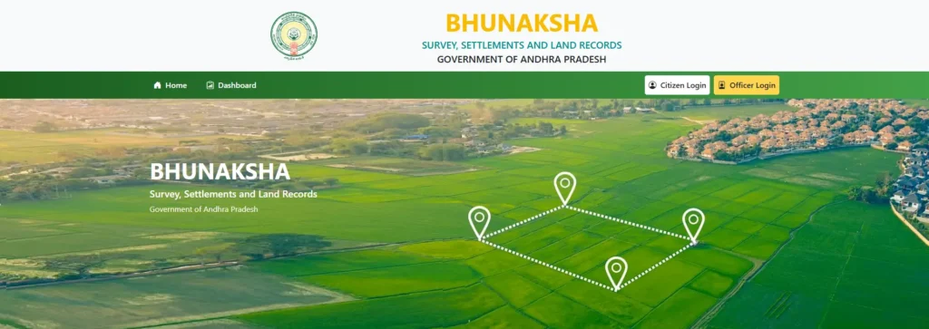
BhuNaksha AP is the official cadastral mapping software engineered to digitize traditional hand-drawn land maps. By leveraging BhuNaksha, the government has moved away from outdated manual registers and physical drawings to a secure, dynamic digital database. This portal integrates graphical map data with textual land records, allowing you to instantly view the legal shape, size, and geographic boundaries of individual land parcels.
BhuNaksha AP vs. Meebhoomi: What’s the Real Difference?
Many first-time users confuse BhuNaksha AP with Meebhoomi, often wondering why Andhra Pradesh has two separate online land portals. While they are intimately linked, they serve fundamentally different purposes in the land administration ecosystem.
- Meebhoomi (Meaning “Your Land” in Telugu): Launched in 2015 by the state’s Revenue Department, this portal is the official system of record for alphanumeric/textual registries. It is your go-to database for proving legal title, verifying mutation history, and downloading text records like the Adangal and ROR-1B.
- BhuNaksha AP: This is the spatial (geographic) database. While Meebhoomi tells you who owns the land (textual), BhuNaksha show you where the boundaries lie and how the plot is shaped (spatial).
Adangal vs. ROR-1B: Alphanumeric Core Documents
To fully appreciate how BhuNaksha links with Meebhoomi, you must understand the two core documents that underpin AP land administration:
1. Meebhoomi Adangal (AP)
The Adangal is a highly detailed agricultural master record maintained at the village level by the Village Revenue Officer (VRO). It acts as a running log of how a piece of land is utilized.
- What it contains: Soil classification (wet vs. dry), water sources, cultivation details, current crop cycle patterns, and tenant details.
- Primary use: It is vital for crop planning, agricultural tax assessment, and as legal proof when applying for crop insurance.
- Cost: Accessing a standard online Adangal copy costs a nominal fee of Rs. 25, while corrections or old Adangal searches cost Rs. 35.
2. Record of Rights (ROR-1B)
The 1B-Register is an official extract of the Record of Rights, focusing strictly on land ownership.
- What it contains: The Pattadar’s (landowner’s) name, father’s name, survey or account numbers, and the precise total extent of land held by the individual in that specific village.
- Primary use: It is the primary document used for legal verification during property sales, title deeds analysis, and bank loan approvals.
- Cost: Checking or downloading a standard ROR-1B costs a flat rate of Rs. 25.
Step-by-Step Guide: How to Check Land Maps Online in AP
If you want to view a property map on BhuNaksha AP, you do not need any specialized GIS training. The National Informatics Centre has designed a highly intuitive browser-based interface. Follow this clear protocol to run an AP land map survey number search:
Navigating the BhuNaksha AP Portal
- Visit the Official Portal: Open your web browser (Firefox or Chrome are highly recommended for optimal loading) and navigate to the official landing page:
https://bhunaksha.ap.gov.in/. - Access the Search Panel: On the left-hand menu sidebar, locate the search parameters.
- Provide Administrative Hierarchies: Input your target property’s specific location details:
- District Name
- Mandal Name
- Village Name
- Execute the Survey Number Search: Select the Survey Number or “Khasra” from the drop-down list. Alternatively, you can click on any highlighted parcel directly on the visual interactive map to load its metadata.
- Review the Plot Details: Once the parcel is selected, the “Plot Info” tab on the left panel will dynamically display the selected survey number, total area in hectares (and local units), the list of owners, and corresponding Meebhoomi ledger links.
What is an FMB (Field Measurement Book) of a Plot?
An FMB (Field Measurement Book) is a compilation of certified land records containing highly detailed map drawings and spatial measurements of a specific land parcel. Each sketch outlines the exact dimensions, angles, neighboring plot boundaries, and geometric coordinate markers of your property.
Historically, these sketches were drawn manually using a chain-and-triangulation method during the colonial British era. Today, these have been fully vectorized and are digitally signed by state land survey officials, making them legally binding documents for dispute resolution.
Custom FMB Report Generation & Printing Protocol
If you need a copy of your FMB for bank verification, legal disputes, or property registration, you can generate a scaled PDF copy directly from BhuNaksha AP:
- Step 1: Log in to the central BhuNaksha AP portal and navigate to the Online Subdivision menu located on the main control panel.
- Step 2: Populate the administrative fields (District, Mandal, Village) and select your target survey number.
- Step 3: Click on the View Report tab, which sits adjacent to the standard FMB printing option.
- Step 4: Scale and Customize: Before printing, the system allows you to configure your document’s presentation layout. You can select standard paper sizes (A4, A3, A2, or A1) and set the custom scale factor (e.g., a scale of
4000will generate a map in a precise1:4000ratio). - Step 5: Click Download PDF to save the generated, high-resolution vector FMB plan to your device for offline use or physical printing.
The Andhra Pradesh Land Resurvey Project: A Digital Revolution
If you talk to any long-time landowner in Andhra Pradesh, they will tell you that land administration has historically been plagued by boundary litigations and land grabbing. This stems from a simple, shocking fact: the last comprehensive land survey in Andhra Pradesh was conducted by the British in 1930!
Over nearly a century, inheritance splits, informal transfers, and physical layout changes have rendered these old paper maps highly inaccurate, leading to endless court disputes.
To resolve this systemic crisis, the state launched a historic, state-wide digital land resurvey initiative titled the “YSR Jagananna Saswatha Bhu Hakku Mariyu Bhu Raksha Pathakam”. This project is closely aligned with the federal PM SVAMITVA Yojana.
Modern Technology Integration (Drones, CORS, & QGIS)
Instead of relying on archaic chains and ropes, modern surveyors are using a highly sophisticated, multi-tiered technology workflow:
- Aerial Drone Photography: Specialized high-resolution drones fly over villages, capturing ultra-clear aerial imagery of physical plot boundaries and markers.
- CORS (Continuously Operating Reference Stations) Network: The drone imagery is geo-referenced using a dense network of CORS ground stations. This provides millimeter-level coordinate accuracy, eliminating errors caused by manual measurement.
- QGIS Processing: Raw spatial data is processed and stitched together using QGIS (an advanced open-source desktop GIS application) to compile highly precise village maps and LPMs (Land Parcel Maps).
- ULPIN (Unique Land Parcel Identification Number): Every single verified plot is assigned a 14-digit geo-referenced ULPIN or LPM number, which acts as a virtual “Aadhaar Card” for your land. This geo-tagging prevents double allotments, eliminates boundary overlaps, and blocks fraudulent registrations.
Legal Milestones: 9(2) Notices and Title Cards
To ensure absolute transparency, the resurvey project incorporates a strict legal validation process:
- Once QGIS finishes drafting a village map, a 9(2) Notice is issued. These notices can be downloaded directly from the official portal at
bhunaksha.ap.gov.in/resurvey. - Landowners are given a formal window to review their mapped boundaries and file objections before the data is frozen.
- Once approved, the owner is granted a permanent, legally secure Bhu Hakku Patram (Title Card), establishing undisputed ownership backed by the state government.
Common Mobile App Scams: Protect Your Data!
As internet usage grows across rural Andhra Pradesh, many citizens prefer using mobile phones to check their records. However, you must exercise extreme caution:
- Warning: There is no official public BhuNaksha AP Mobile App.
- The “AP SSLR Resurvey” app available on Google Play is restricted strictly to licensed internal department personnel and survey officers for field logging.
- Many third-party apps, such as Bhu Naksha Info Online or mypatta, pull data from public servers to show maps. While convenient, many of these apps contain invasive advertisements and require excessive device permissions.
- Rule of Thumb: Never enter confidential banking credentials, Aadhaar details, or pay fees on unofficial mobile applications. For stamped, legally certified copies, always use the secure MeeSeva portal or visit your local Village Secretariat.
BhuNaksha AP Frequently Asked Questions (FAQs)
Can I search for land maps on BhuNaksha AP using an owner’s name?
No, BhuNaksha AP is a spatial database and does not support search by name. You must have the specific village details and survey/LPM number. However, if you only have the owner’s name, you can first log into the Meebhoomi portal, use the “Search by Name” feature to retrieve the corresponding survey number, and then plug that survey number into BhuNaksha.
How much does it cost to view and download AP land maps online?
Viewing, navigating, and downloading standard reference land maps or custom PDF FMB reports directly from the official BhuNaksha AP portal is entirely free of cost. However, if you require a legally stamped, physical certified copy for court submissions or formal bank loan applications, you must request one through MeeSeva or your local Village Secretariat for a nominal government-mandated fee.
What should I do if my physical land boundary does not match the BhuNaksha digital map?
Discrepancies can occur, especially in areas where the modern drone resurvey has not yet been fully finalized and frozen. If you find a boundary error, you should immediately file a formal dispute/grievance through the Meebhoomi Grievance Cell or submit a correction application at your local Village Secretariat or Mandal Revenue Office (MRO). Surveyors will then execute an on-ground physical stone verification using coordinate GPS equipment to rectify the digital map database.